Downstream side of Ireland Bridge, Bingley
Introduction
The photograph on this page of Downstream side of Ireland Bridge, Bingley by Stephen Craven as part of the Geograph project.
The Geograph project started in 2005 with the aim of publishing, organising and preserving representative images for every square kilometre of Great Britain, Ireland and the Isle of Man.

There are currently over 7.5m images from over 14,400 individuals and you can help contribute to the project by visiting https://www.geograph.org.uk
Downstream side of Ireland Bridge, Bingley
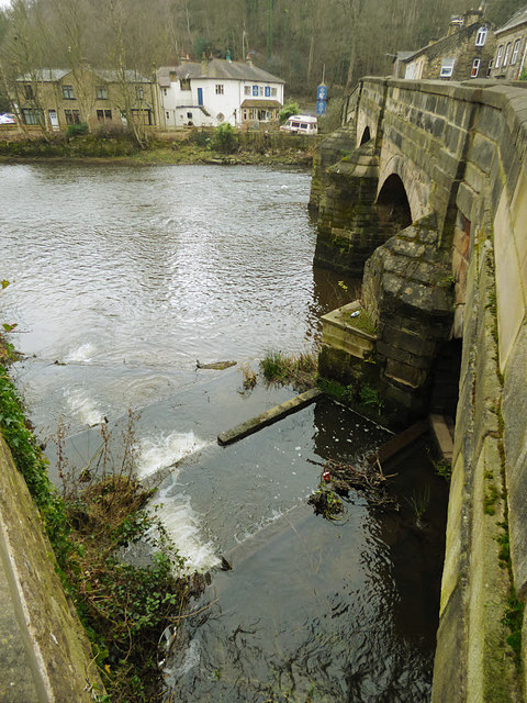
Image: © Stephen Craven Taken: 13 Jan 2018
There is a weir across the river upstream of the bridge, and the fish ladder in the foreground is at the end of that. The bridge itself is grade 2* listed (list entry 1133377) as being "virtually unaltered" since it was re-built in 1686, other than the 18th century parapet.
Images are licensed for reuse under creativecommons.org/licenses/by-sa/2.0
Image Location


Leaflet Map data © OpenStreetMap
Latitude
53.850281
Longitude
-1.841572