Footpath to Thwaites Brow (5)
Introduction
The photograph on this page of Footpath to Thwaites Brow (5) by Stephen Craven as part of the Geograph project.
The Geograph project started in 2005 with the aim of publishing, organising and preserving representative images for every square kilometre of Great Britain, Ireland and the Isle of Man.

There are currently over 7.5m images from over 14,400 individuals and you can help contribute to the project by visiting https://www.geograph.org.uk
Footpath to Thwaites Brow (5)
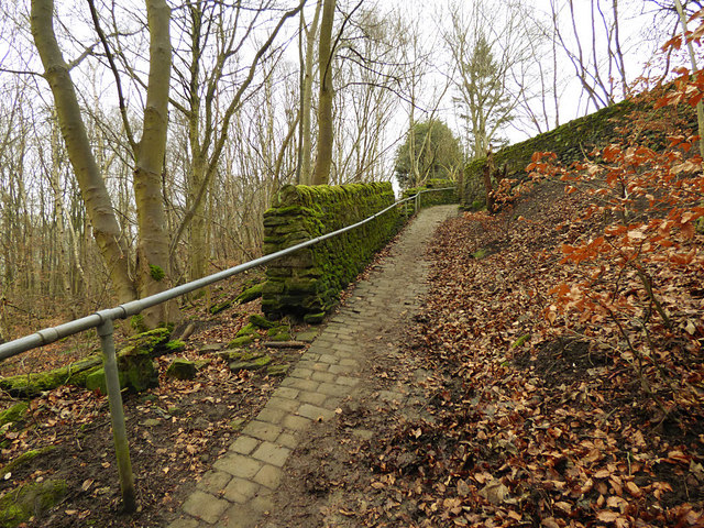
Image: © Stephen Craven Taken: 13 Jan 2018
A splendid example of a stone-setted footpath from the days of the Industrial Revolution, which appears on maps as early as 1852. I presume it was for workers to reach the factories in the town of Keighley (and at another time maybe for quarry workers living in the valley bottom to reach the quarries higher up the hill). This view is at Park Wood Top and shows how a modern metal handrail has supplemented and in some places replaced the stone wall.
Images are licensed for reuse under creativecommons.org/licenses/by-sa/2.0
Image Location


Leaflet Map data © OpenStreetMap
Latitude
53.863998
Longitude
-1.892003