Capel Cefnarthen
Introduction
The photograph on this page of Capel Cefnarthen by Alan Richards as part of the Geograph project.
The Geograph project started in 2005 with the aim of publishing, organising and preserving representative images for every square kilometre of Great Britain, Ireland and the Isle of Man.

There are currently over 7.5m images from over 14,400 individuals and you can help contribute to the project by visiting https://www.geograph.org.uk
Capel Cefnarthen
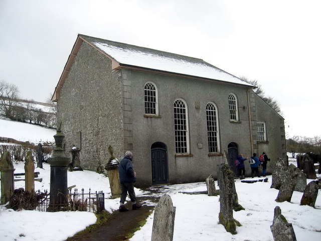
Image: © Alan Richards Taken: 5 Mar 2006
Cefnarthen, addoldy'r Annibynwyr ac adeiladwyd y capel cyntaf yn 1689. Codwyd yr adeilad presennol yn 1854 a hwn yw'r trydydd ty cwrdd a codwyd ar y safle. Cefnarthen, the meeting house of the Independents and the first chapel was erected in 1689. The present building, built in 1854, is the third chapel to be erected on the site.
Images are licensed for reuse under creativecommons.org/licenses/by-sa/2.0
Image Location


Leaflet Map data © OpenStreetMap
Latitude
52.001979
Longitude
-3.692814