Otterham Quay Lane
Introduction
The photograph on this page of Otterham Quay Lane by Stephen McKay as part of the Geograph project.
The Geograph project started in 2005 with the aim of publishing, organising and preserving representative images for every square kilometre of Great Britain, Ireland and the Isle of Man.

There are currently over 7.5m images from over 14,400 individuals and you can help contribute to the project by visiting https://www.geograph.org.uk
Otterham Quay Lane
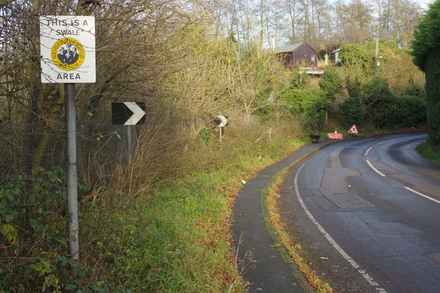
Image: © Stephen McKay Taken: 19 Dec 2017
The road bends round towards Upchurch, the sign making it clear that this is a Swale neighbourhood watch area. The road works sign was in connection with hedge trimming.
Images are licensed for reuse under creativecommons.org/licenses/by-sa/2.0
Image Location


Leaflet Map data © OpenStreetMap
Latitude
51.373327
Longitude
0.629871