Rundles Walk
Introduction
The photograph on this page of Rundles Walk by Tony Atkin as part of the Geograph project.
The Geograph project started in 2005 with the aim of publishing, organising and preserving representative images for every square kilometre of Great Britain, Ireland and the Isle of Man.

There are currently over 7.5m images from over 14,400 individuals and you can help contribute to the project by visiting https://www.geograph.org.uk
Rundles Walk
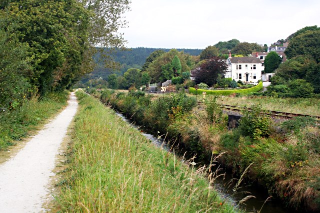
Image: © Tony Atkin Taken: 22 Sep 2007
The footpath is known as Rundles Walk. It parallels the Luxulyan River which has fairly obviously been straightened and on the other side of the river is the Newquay Branch Railway Line.
Images are licensed for reuse under creativecommons.org/licenses/by-sa/2.0
Image Location
Latitude
50.35928
Longitude
-4.712493