Burwarton Parish milepost
Introduction
The photograph on this page of Burwarton Parish milepost by Richard Law as part of the Geograph project.
The Geograph project started in 2005 with the aim of publishing, organising and preserving representative images for every square kilometre of Great Britain, Ireland and the Isle of Man.

There are currently over 7.5m images from over 14,400 individuals and you can help contribute to the project by visiting https://www.geograph.org.uk
Burwarton Parish milepost
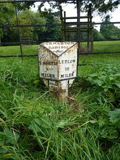
Image: © Richard Law Taken: 24 Sep 2017
Located in the village, more or less opposite the school. It's hard to read the foundry name now (maybe J Onions, which suggests the Banks & Onions company of Broseley) but it's dated 1845.
Images are licensed for reuse under creativecommons.org/licenses/by-sa/2.0
Image Location
Latitude
52.463404
Longitude
-2.562414