Strathblane and Dumgoyne from the air
Introduction
The photograph on this page of Strathblane and Dumgoyne from the air by Thomas Nugent as part of the Geograph project.
The Geograph project started in 2005 with the aim of publishing, organising and preserving representative images for every square kilometre of Great Britain, Ireland and the Isle of Man.

There are currently over 7.5m images from over 14,400 individuals and you can help contribute to the project by visiting https://www.geograph.org.uk
Strathblane and Dumgoyne from the air
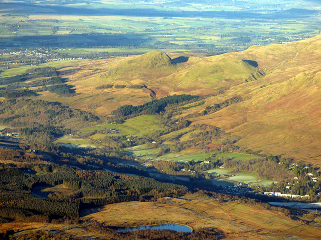
Image: © Thomas Nugent Taken: 11 Dec 2017
Dumbrock Loch is in the foreground. 427m Dumgoyne is the left pinnacle, 426m Dumfoyne is to its right.
Images are licensed for reuse under creativecommons.org/licenses/by-sa/2.0
Image Location
Latitude
55.977667
Longitude
-4.31731