Little Gourdas
Introduction
The photograph on this page of Little Gourdas by Anne Burgess as part of the Geograph project.
The Geograph project started in 2005 with the aim of publishing, organising and preserving representative images for every square kilometre of Great Britain, Ireland and the Isle of Man.

There are currently over 7.5m images from over 14,400 individuals and you can help contribute to the project by visiting https://www.geograph.org.uk
Little Gourdas
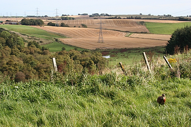
Image: © Anne Burgess Taken: 21 Sep 2007
It's photographs like this one which remind me how lines of pylons can dominate, and (depending on your opinion of pylons) spoil, a view. The burn at the foot of the hollow is the Tennen Burn, which drains the Howe Moss into the River Ythan via the Skeugh Burn. Note the young pheasant at lower right. The whole place was hotching with young pheasants and red-legged partridges.
Images are licensed for reuse under creativecommons.org/licenses/by-sa/2.0
Image Location


Leaflet Map data © OpenStreetMap
Latitude
57.460312
Longitude
-2.386835