Little Gourdas
Introduction
The photograph on this page of Little Gourdas by Anne Burgess as part of the Geograph project.
The Geograph project started in 2005 with the aim of publishing, organising and preserving representative images for every square kilometre of Great Britain, Ireland and the Isle of Man.

There are currently over 7.5m images from over 14,400 individuals and you can help contribute to the project by visiting https://www.geograph.org.uk
Little Gourdas
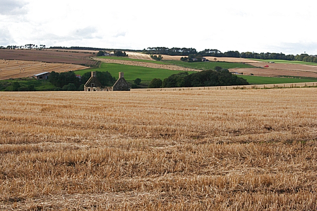
Image: © Anne Burgess Taken: 21 Sep 2007
The walls of a ruined cottage on Little Gourdas. Curiously, it isn't marked at all on the 1873 Ordnance Survey map, though it is on later ones, so it seems that it may have been built after 1873 and abandoned after about a hundred years. The clump of trees to its right is called The Rounder according to the 1:25,000 map.
Images are licensed for reuse under creativecommons.org/licenses/by-sa/2.0
Image Location


Leaflet Map data © OpenStreetMap
Latitude
57.459029
Longitude
-2.394821