Worcester City Football Ground
Introduction
The photograph on this page of Worcester City Football Ground by Philip Halling as part of the Geograph project.
The Geograph project started in 2005 with the aim of publishing, organising and preserving representative images for every square kilometre of Great Britain, Ireland and the Isle of Man.

There are currently over 7.5m images from over 14,400 individuals and you can help contribute to the project by visiting https://www.geograph.org.uk
Worcester City Football Ground
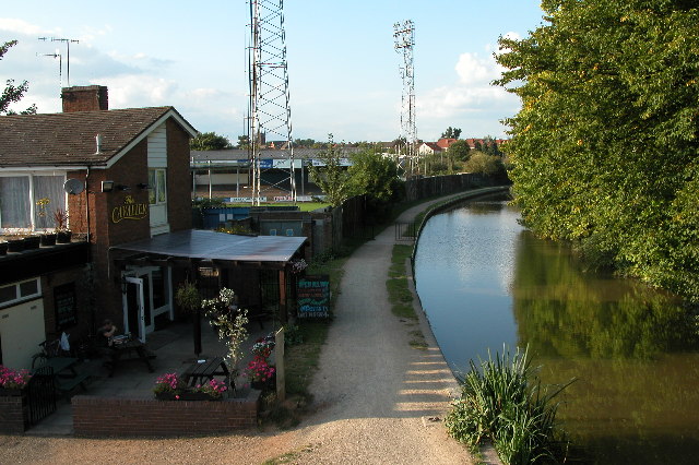
Image: © Philip Halling Taken: 20 Sep 2005
The Worcester and Birmingham canal passes alongside the Worcester City football ground. On the left is the Cavalier public house.
Images are licensed for reuse under creativecommons.org/licenses/by-sa/2.0
Image Location


Leaflet Map data © OpenStreetMap
Latitude
52.20382
Longitude
-2.220908