Old Milestone by the B6296, Low Redgate Bank
Introduction
The photograph on this page of Old Milestone by the B6296, Low Redgate Bank by Mike Rayner as part of the Geograph project.
The Geograph project started in 2005 with the aim of publishing, organising and preserving representative images for every square kilometre of Great Britain, Ireland and the Isle of Man.

There are currently over 7.5m images from over 14,400 individuals and you can help contribute to the project by visiting https://www.geograph.org.uk
Old Milestone by the B6296, Low Redgate Bank
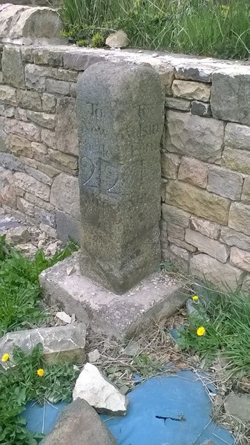
Image: © Mike Rayner Taken: 22 Apr 2016
Stone post (plate lost) by the B6296, in parish of WOLSINGHAM (WEAR VALLEY District), Redgate, North end of stone cottage wall, against stone wall, on North side of road. Wolsingham stone, erected by the Lobley Hill & branches turnpike trust in the 18th century. Inscription reads:- : To / New / castle / 22 Miles : : To / Wolsing / ham / 1 Mile : Milestone Society National ID: DU_GHWO22.
Images are licensed for reuse under creativecommons.org/licenses/by-sa/2.0
Image Location
Latitude
54.737823
Longitude
-1.871852