Old Milestone north east of Thornford
Introduction
The photograph on this page of Old Milestone north east of Thornford by J Tybjerg as part of the Geograph project.
The Geograph project started in 2005 with the aim of publishing, organising and preserving representative images for every square kilometre of Great Britain, Ireland and the Isle of Man.

There are currently over 7.5m images from over 14,400 individuals and you can help contribute to the project by visiting https://www.geograph.org.uk
Old Milestone north east of Thornford
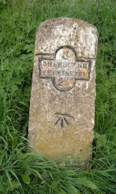
Image: © J Tybjerg Taken: 9 Oct 2002
Metal plate attached to stone post by the UC road, in parish of THORNFORD (WEST DORSET District), just North East of the village, on grass verge by hedge, on North side of road. Dorset 4 (iron plated), erected by the Sherborne turnpike trust in the 19th century. Inscription reads:- 3 SHERBORNE YETMINSTER 2½ Carved benchmark centre of front face. Milestone Society National ID: DO_SBYT03.
Images are licensed for reuse under creativecommons.org/licenses/by-sa/2.0
Image Location
Latitude
50.920985
Longitude
-2.5555