Old Milestone by the B3277, south of Hurlingbarrow
Introduction
The photograph on this page of Old Milestone by the B3277, south of Hurlingbarrow by Ian Thompson as part of the Geograph project.
The Geograph project started in 2005 with the aim of publishing, organising and preserving representative images for every square kilometre of Great Britain, Ireland and the Isle of Man.

There are currently over 7.5m images from over 14,400 individuals and you can help contribute to the project by visiting https://www.geograph.org.uk
Old Milestone by the B3277, south of Hurlingbarrow
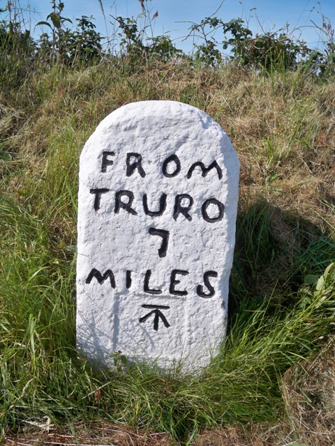
Image: © Ian Thompson Taken: 1 Oct 1996
Carved stone post by the B3277, in parish of ST AGNES (CARRICK District), Hurlingbarrow, opposite filling station by crossroads, by the road, on West side of road. Truro stone, erected by the Truro turnpike trust in the 18th century. Inscription reads:- FROM TRURO 7 MILES Carved benchmark on front face. Grade II Listed. List Entry Number:1141530 https://historicengland.org.uk/listing/the-list/list-entry/1141530 Milestone Society National ID: CW_TOAG07.
Images are licensed for reuse under creativecommons.org/licenses/by-sa/2.0
Image Location


Leaflet Map data © OpenStreetMap
Latitude
50.292218
Longitude
-5.192131