Old Milestone by the A391, south of Bugle
Introduction
The photograph on this page of Old Milestone by the A391, south of Bugle by Ian Thompson as part of the Geograph project.
The Geograph project started in 2005 with the aim of publishing, organising and preserving representative images for every square kilometre of Great Britain, Ireland and the Isle of Man.

There are currently over 7.5m images from over 14,400 individuals and you can help contribute to the project by visiting https://www.geograph.org.uk
Old Milestone by the A391, south of Bugle
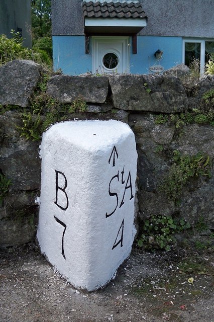
Image: © Ian Thompson Taken: 1 Nov 1995
Carved stone post by the A391, in parish of ST AUSTELL (RESTORMEL District), South of Bugle, by semi-detached house called "Milestone", by the road, on West side of road. Bodmin Roche stone, erected by the Bodmin & Roche turnpike trust in the 19th century. Inscription reads:- : B / 7 : : St A / 4 : Carved benchmark on right side face, rivet on top Grade II Listed. List Entry Number: 1394417 https://historicengland.org.uk/listing/the-list/list-entry/1394417 Milestone Society National ID: CW_SABM04.
Images are licensed for reuse under creativecommons.org/licenses/by-sa/2.0
Image Location
Latitude
50.389722
Longitude
-4.79443