Old Milestone by the B3297, south of Farms Common
Introduction
The photograph on this page of Old Milestone by the B3297, south of Farms Common by Ian Thompson as part of the Geograph project.
The Geograph project started in 2005 with the aim of publishing, organising and preserving representative images for every square kilometre of Great Britain, Ireland and the Isle of Man.

There are currently over 7.5m images from over 14,400 individuals and you can help contribute to the project by visiting https://www.geograph.org.uk
Old Milestone by the B3297, south of Farms Common
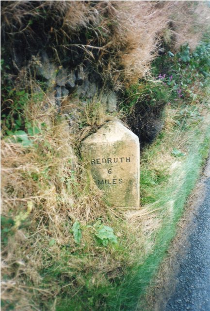
Image: © Ian Thompson Taken: 10 Dec 2017
Carved stone post by the B3297, in parish of WENDRON (KERRIER District), Boquio Vean, narrow (dangerous) approach to brow of hill, by the road, on West side of road. Erected by the Local Highways Board in the 19th century. Inscription reads:- : REDRUTH / 6 / MILES : : HELSTON / 4 / MILES : Grade II Listed. List Entry Number: 1142008 https://historicengland.org.uk/listing/the-list/list-entry/1142008 Milestone Society National ID: CW_RRHL06.
Images are licensed for reuse under creativecommons.org/licenses/by-sa/2.0
Image Location
Latitude
50.153819
Longitude
-5.251926