Old Milestone by the B3275, north of Hewas
Introduction
The photograph on this page of Old Milestone by the B3275, north of Hewas by Ian Thompson as part of the Geograph project.
The Geograph project started in 2005 with the aim of publishing, organising and preserving representative images for every square kilometre of Great Britain, Ireland and the Isle of Man.

There are currently over 7.5m images from over 14,400 individuals and you can help contribute to the project by visiting https://www.geograph.org.uk
Old Milestone by the B3275, north of Hewas
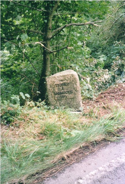
Image: © Ian Thompson Taken: 1 Sep 2005
Metal plates attached to stone post by the B3275 (was A39), in parish of ST ENODER (RESTORMEL District), Hewas, on verge, leaning away from road, on East side of road. Truro iron plate, erected by the Truro turnpike trust in the 19th century. Inscription reads:- : TRURO / 9 / FALMOUTH / 19½ : : BODMIN / 15¼ / LONDON / 241 : Grade II Listed. List Entry Number: 1393902 https://historicengland.org.uk/listing/the-list/list-entry/1393902 Milestone Society National ID: CW_BMTO15.
Images are licensed for reuse under creativecommons.org/licenses/by-sa/2.0
Image Location
Latitude
50.344948
Longitude
-4.943265