Old Milestone by the unclassified road, west of Langrigg Farm
Introduction
The photograph on this page of Old Milestone by the unclassified road, west of Langrigg Farm by CF Smith as part of the Geograph project.
The Geograph project started in 2005 with the aim of publishing, organising and preserving representative images for every square kilometre of Great Britain, Ireland and the Isle of Man.

There are currently over 7.5m images from over 14,400 individuals and you can help contribute to the project by visiting https://www.geograph.org.uk
Old Milestone by the unclassified road, west of Langrigg Farm
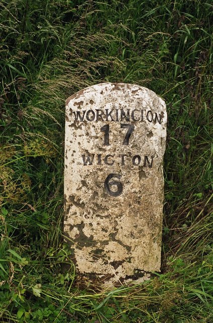
Image: © CF Smith Taken: 16 Sep 2005
Carved stone post by the UC road, in parish of BROMFIELD (ALLERDALE District), Houserigg, South of Langrigg, on grass verge, on North side of road. Wigton curved red stone, erected by the Cockermouth & Maryport turnpike trust in the 19th century. Inscription reads:- WORKINGTON 17 WIGTON 6 Grade II Listed. List Entry Number: 1235082 https://historicengland.org.uk/listing/the-list/list-entry/1235082 Milestone Society National ID: CU_WGWO06.
Images are licensed for reuse under creativecommons.org/licenses/by-sa/2.0
Image Location
Latitude
54.795352
Longitude
-3.297108