Old Milestone by the A69, south of Gowanholes Wood
Introduction
The photograph on this page of Old Milestone by the A69, south of Gowanholes Wood by CF Smith as part of the Geograph project.
The Geograph project started in 2005 with the aim of publishing, organising and preserving representative images for every square kilometre of Great Britain, Ireland and the Isle of Man.

There are currently over 7.5m images from over 14,400 individuals and you can help contribute to the project by visiting https://www.geograph.org.uk
Old Milestone by the A69, south of Gowanholes Wood
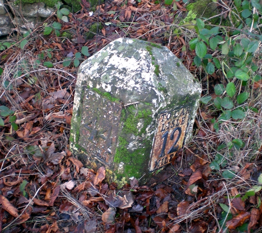
Image: © CF Smith Taken: 9 Dec 2009
Metal plates attached to stone post by the A69, in parish of BRAMPTON (CARLISLE District), South of Gowanholes Wood, 200 East of lane to Naworth Castle, on grass verge, on North side of road. Military Road plate, erected by the Carlisle & Temon (Military Road) turnpike trust in the 19th century. Inscription reads:- : TO NEW / CASTLE / 44 / MILES : : TO CAR / LISLE / 12 / MILES : Carved benchmark. Grade II Listed. List Entry Number: 1335526 https://historicengland.org.uk/listing/the-list/list-entry/1335526 Milestone Society National ID: CU_CLNC12.
Images are licensed for reuse under creativecommons.org/licenses/by-sa/2.0
Image Location


Leaflet Map data © OpenStreetMap
Latitude
54.950667
Longitude
-2.677738