Old Milestone by the A6071, east of Brampton
Introduction
The photograph on this page of Old Milestone by the A6071, east of Brampton by T Moore as part of the Geograph project.
The Geograph project started in 2005 with the aim of publishing, organising and preserving representative images for every square kilometre of Great Britain, Ireland and the Isle of Man.

There are currently over 7.5m images from over 14,400 individuals and you can help contribute to the project by visiting https://www.geograph.org.uk
Old Milestone by the A6071, east of Brampton
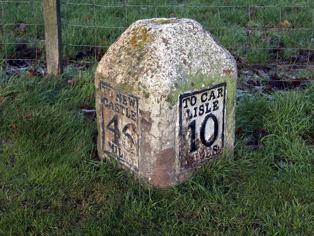
Image: © T Moore Taken: 20 Jun 2013
Metal plates attached to stone post by the A6071, in parish of BRAMPTON (CARLISLE District), bottom of hill at eastern exit of Town Green, East of The Sands, on cut verge, by 30 sign, between path and wire fence, on North side of road. Military Road plate, erected by the Carlisle & Temon (Military Road) turnpike trust in the 19th century. Inscription reads:- : TO NEW / CASTLE / 46 / MILES : : TO CAR / LISLE / 10 / MILES : Grade II Listed. List Entry Number: 1087660 https://historicengland.org.uk/listing/the-list/list-entry/1087660 Milestone Society National ID: CU_CLNC10.
Images are licensed for reuse under creativecommons.org/licenses/by-sa/2.0
Image Location
Latitude
54.943393
Longitude
-2.725072