Old Milestone by the A69, Corby Hill
Introduction
The photograph on this page of Old Milestone by the A69, Corby Hill by CF Smith as part of the Geograph project.
The Geograph project started in 2005 with the aim of publishing, organising and preserving representative images for every square kilometre of Great Britain, Ireland and the Isle of Man.

There are currently over 7.5m images from over 14,400 individuals and you can help contribute to the project by visiting https://www.geograph.org.uk
Old Milestone by the A69, Corby Hill
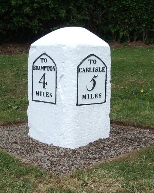
Image: © CF Smith Taken: 7 Dec 2005
Metal plate attached to stone post by the A69, in parish of HAYTON (CARLISLE District), Corby Hill, East of Warwick, 100m South West of traffic lights, nearly opposite petrol station, on wide cut grass verge, between footpath and domestic hedge, on North side of road. Carlisle plate, erected by the Carlisle & Brampton turnpike trust in the 19th century. Inscription reads:- : TO / BRAMPTON / 4 / MILES : : TO / CARLISLE / 5 / MILES : Grade II Listed. List Entry Number: 1087542 https://historicengland.org.uk/listing/the-list/list-entry/1087542 Milestone Society National ID: CU_CLBR05.
Images are licensed for reuse under creativecommons.org/licenses/by-sa/2.0
Image Location
Latitude
54.90519
Longitude
-2.814592