Boundary Stone in front of #169 Fulford Road, York
Introduction
The photograph on this page of Boundary Stone in front of #169 Fulford Road, York by John S Turner as part of the Geograph project.
The Geograph project started in 2005 with the aim of publishing, organising and preserving representative images for every square kilometre of Great Britain, Ireland and the Isle of Man.

There are currently over 7.5m images from over 14,400 individuals and you can help contribute to the project by visiting https://www.geograph.org.uk
Boundary Stone in front of #169 Fulford Road, York
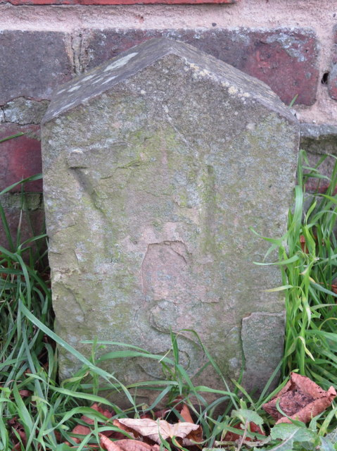
Image: © John S Turner Taken: 17 Nov 2017
This boundary stone stands in front of #169 Fulford Road, York, marking a right angled corner in the boundary. Although it is deteriorating it seems to be inscribed 'Y I S', which I can't decipher - apart from the 'Y' for York. Old-maps show the boundary with various titles, but the 1891 map describes the north side "County & Parliamentary Borough Boundary (York)", and to the south "Parliamentary County Division Boundary". Milestone Society National ID: YW_YORFUL01pb.
Images are licensed for reuse under creativecommons.org/licenses/by-sa/2.0
Image Location
Latitude
53.939841
Longitude
-1.073923