War Department Boundary Stone #16 - Imphal Barracks
Introduction
The photograph on this page of War Department Boundary Stone #16 - Imphal Barracks by John S Turner as part of the Geograph project.
The Geograph project started in 2005 with the aim of publishing, organising and preserving representative images for every square kilometre of Great Britain, Ireland and the Isle of Man.

There are currently over 7.5m images from over 14,400 individuals and you can help contribute to the project by visiting https://www.geograph.org.uk
War Department Boundary Stone #16 - Imphal Barracks
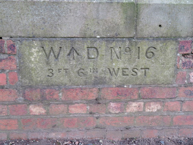
Image: © John S Turner Taken: 15 Nov 2017
This WD BS #16 is set into the front wall of Imphal Barracks on the east side of Fulford Road. It is the last of a set of 16 stones that once surrounded the large split military site. Some stones have gone, some I have missed, and some are still within secure MOD property. I have photographed just six of the existing stones. The inscription "3FT 6IN West" refers to the fact that the boundary of the barracks at this point is actually Three feet six inches further out than the face of the wall. See also: Image, Image, Image, Image and Image Milestone Society National ID: YW_WDIMYO16em
Images are licensed for reuse under creativecommons.org/licenses/by-sa/2.0
Image Location
Latitude
53.944513
Longitude
-1.073668