
Closed public conveniences, Crystal Palace Parade, south London
Introduction
The photograph on this page of Closed public conveniences, Crystal Palace Parade, south London by Robin Stott as part of the Geograph project.
The Geograph project started in 2005 with the aim of publishing, organising and preserving representative images for every square kilometre of Great Britain, Ireland and the Isle of Man.

There are currently over 7.5m images from over 14,400 individuals and you can help contribute to the project by visiting https://www.geograph.org.uk
Closed public conveniences, Crystal Palace Parade, south London
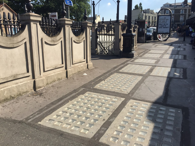
Image: © Robin Stott Taken: 27 Aug 2017
'Luxcrete' – paving and rooflight at the same time – consisted of glass blocks set in a cast iron or reinforced concrete frame. It transmitted light to the public toilets below, while forming a smooth paved surface. These toilets must have been very busy with visitors in the past, being near the entrance to Crystal Palace itself and the Park, pubs and bus stops, and the high-level railway station. First appearance of this amenity on a map is as 'Urinal' in 1912. Another view is Image
Images are licensed for reuse under creativecommons.org/licenses/by-sa/2.0
Image Location

Latitude
51.420276
Longitude
-0.078703