Secret Nuclear Bunker
Introduction
The photograph on this page of Secret Nuclear Bunker by Hywel Williams as part of the Geograph project.
The Geograph project started in 2005 with the aim of publishing, organising and preserving representative images for every square kilometre of Great Britain, Ireland and the Isle of Man.

There are currently over 7.5m images from over 14,400 individuals and you can help contribute to the project by visiting https://www.geograph.org.uk
Secret Nuclear Bunker
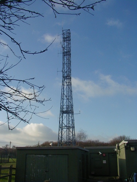
Image: © Hywel Williams Taken: Unknown
This nuclear bunker is laughingly listed on Ordnance Survey maps as "Secret Nuclear Bunker". Obviously no longer a secret, this bunker used to form a part of the cold war nuclear defence system and was a regional seat of government. Should the worst happen, the local area would be governed by the officials who would shelter here. This bunker would also be in communication with numerous Royal Observer Corps outposts dotted around the countryside similar to the one shown in Image, so that they could assess the damage caused by a nuclear attack. It was open to the public until comparatively recently (hence the name on the Ordnance Survey map) but now stands empty, a monument to something that thankfully didn't happen.
Images are licensed for reuse under creativecommons.org/licenses/by-sa/2.0
Image Location


Leaflet Map data © OpenStreetMap
Latitude
51.939758
Longitude
1.084278