Former mill stream, Toppesfield Mill
Introduction
The photograph on this page of Former mill stream, Toppesfield Mill by Robin Webster as part of the Geograph project.
The Geograph project started in 2005 with the aim of publishing, organising and preserving representative images for every square kilometre of Great Britain, Ireland and the Isle of Man.

There are currently over 7.5m images from over 14,400 individuals and you can help contribute to the project by visiting https://www.geograph.org.uk
Former mill stream, Toppesfield Mill
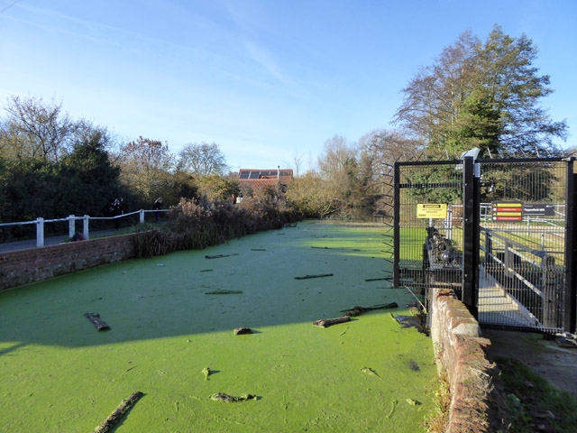
Image: © Robin Webster Taken: 19 Nov 2017
The mill burnt down in the 1920s, and now nothing is left of the actual mill apart from a machinery foundation block - the mill race is filled in. The River Brett passes through sluices on the right, when open (they seemed almost closed), and beyond these, over a weir. Weed and debris have accumulated in this dead leg.
Images are licensed for reuse under creativecommons.org/licenses/by-sa/2.0
Image Location
Latitude
52.040151
Longitude
0.953661