Crudgington House
Introduction
The photograph on this page of Crudgington House by Richard Law as part of the Geograph project.
The Geograph project started in 2005 with the aim of publishing, organising and preserving representative images for every square kilometre of Great Britain, Ireland and the Isle of Man.

There are currently over 7.5m images from over 14,400 individuals and you can help contribute to the project by visiting https://www.geograph.org.uk
Crudgington House
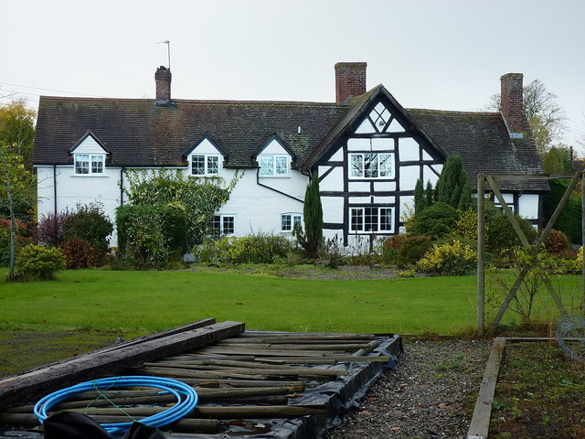
Image: © Richard Law Taken: 5 Nov 2017
A rather fine house, Grade II listed https://www.britishlistedbuildings.co.uk/101038600-crudgington-house-waters-upton in 1983. The timber-framed part dates back to the late 16th or early 17th century, whilst the brick extension (on the left here) is 19th century.
Images are licensed for reuse under creativecommons.org/licenses/by-sa/2.0
Image Location
Latitude
52.759335
Longitude
-2.5466