Drury's Dam Viaduct, Mansfield, Notts.
Introduction
The photograph on this page of Drury's Dam Viaduct, Mansfield, Notts. by David Hallam-Jones as part of the Geograph project.
The Geograph project started in 2005 with the aim of publishing, organising and preserving representative images for every square kilometre of Great Britain, Ireland and the Isle of Man.

There are currently over 7.5m images from over 14,400 individuals and you can help contribute to the project by visiting https://www.geograph.org.uk
Drury's Dam Viaduct, Mansfield, Notts.
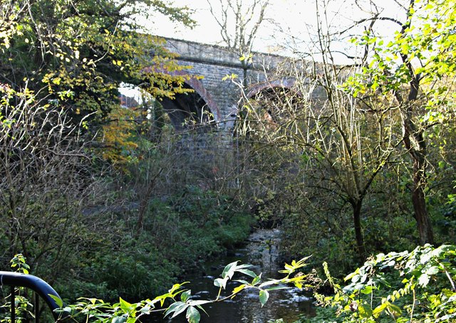
Image: © David Hallam-Jones Taken: 19 Nov 2017
The River Maun, heading in the direction of the town centre, is seen from a footbridge in Quarry Lane Local Nature Reserve. The footbridge, atop a former sluice gate, carries the Timberland Trail across the river. The Timberland Trail starts at Kingsmill Reservoir and follows a route around the southern edge of the town centre, joining the Mansfield Way at Racecourse Road. This walking and cycling path joins the route formerly followed by the Mansfield - Southwell railway line at Fisher Lane Park. It is also possible to exit this nature reserve a stone’s throw from this footbridge and to join Quarry Lane, a road that runs past the town’s football stadium. The Maun Valley Trail is carried across the river and this nature reserve by the viaduct.
Images are licensed for reuse under creativecommons.org/licenses/by-sa/2.0
Image Location
Latitude
53.135235
Longitude
-1.207007