Britannia Point, Christchurch Road, SW19
Introduction
The photograph on this page of Britannia Point, Christchurch Road, SW19 by David Kemp as part of the Geograph project.
The Geograph project started in 2005 with the aim of publishing, organising and preserving representative images for every square kilometre of Great Britain, Ireland and the Isle of Man.

There are currently over 7.5m images from over 14,400 individuals and you can help contribute to the project by visiting https://www.geograph.org.uk
Britannia Point, Christchurch Road, SW19
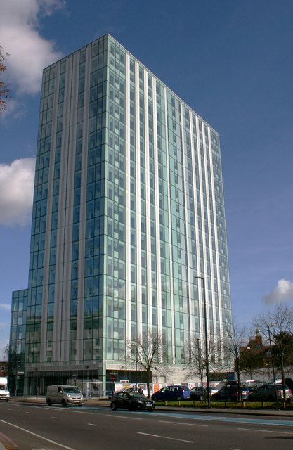
Image: © David Kemp Taken: 25 Oct 2017
Built in 1966 and known variously over the years as Lyon Tower, The Vortex, Brown & Root Tower, this multi-storey block was voted in 2006 as one of the ugliest buildings in the country. But with its refurbishment only recently completed, it has lost much of its former Brutalist grimness.
Images are licensed for reuse under creativecommons.org/licenses/by-sa/2.0
Image Location
Latitude
51.417373
Longitude
-0.178491