
Railway to the west of Harris Drive
Introduction
The photograph on this page of Railway to the west of Harris Drive by Stephen Craven as part of the Geograph project.
The Geograph project started in 2005 with the aim of publishing, organising and preserving representative images for every square kilometre of Great Britain, Ireland and the Isle of Man.

There are currently over 7.5m images from over 14,400 individuals and you can help contribute to the project by visiting https://www.geograph.org.uk
Railway to the west of Harris Drive
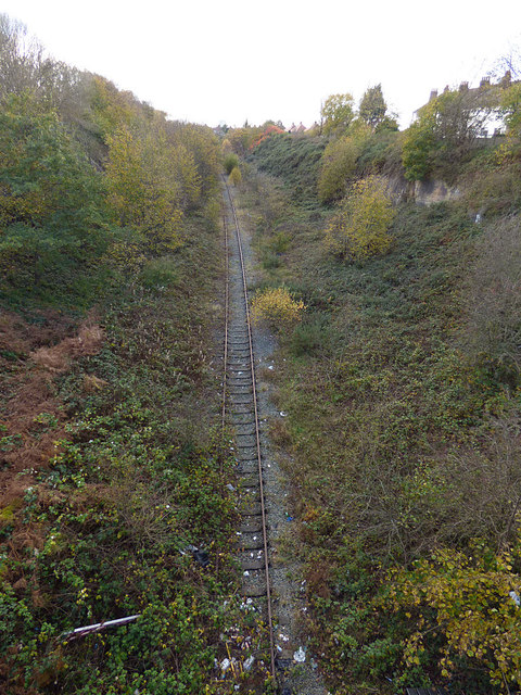
Image: © Stephen Craven Taken: 4 Nov 2017
This cutting once contained the two tracks of the Fazakerley to Bootle (North Mersey) line. Only one track remains, and this apparently has been disused since 2005 (the line saw no regular traffic since it lost its connection to the docks in 1971). Although the route would make a fine cycleway, as an extension of the Liverpool Extension Line (NCN62), it seems Network Rail wants to hang on to it just in case a passenger service can be revived in future.
Images are licensed for reuse under creativecommons.org/licenses/by-sa/2.0
Image Location

Latitude
53.469634
Longitude
-2.984431