
The Dysart Arms, Bunbury
Introduction
The photograph on this page of The Dysart Arms, Bunbury by Stephen McKay as part of the Geograph project.
The Geograph project started in 2005 with the aim of publishing, organising and preserving representative images for every square kilometre of Great Britain, Ireland and the Isle of Man.

There are currently over 7.5m images from over 14,400 individuals and you can help contribute to the project by visiting https://www.geograph.org.uk
The Dysart Arms, Bunbury
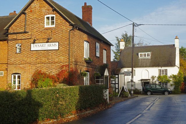
Image: © Stephen McKay Taken: 10 Nov 2017
This is the older part of Bunbury village, sometimes referred to as Higher Bunbury; there are a few cottages, the Dysart Arms and St Boniface's Church here, but most activity is nowadays in Lower Bunbury. The pub takes its name from the local landowners, the Tollemache family who were the Earls of Dysart. It is now part of the Brunning and Price Chain and is well regarded for its food as well as its range of real ales and whiskeys.
Images are licensed for reuse under creativecommons.org/licenses/by-sa/2.0
Image Location

Latitude
53.11841
Longitude
-2.646174