The eastern end of Greencroft, Bilston, Wolverhampton
Introduction
The photograph on this page of The eastern end of Greencroft, Bilston, Wolverhampton by Roger D Kidd as part of the Geograph project.
The Geograph project started in 2005 with the aim of publishing, organising and preserving representative images for every square kilometre of Great Britain, Ireland and the Isle of Man.

There are currently over 7.5m images from over 14,400 individuals and you can help contribute to the project by visiting https://www.geograph.org.uk
The eastern end of Greencroft, Bilston, Wolverhampton
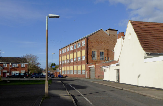
Image: © Roger D Kidd Taken: 10 Nov 2017
Looking WNW towards The Crescent and the A41 Wellington Road to Wolverhampton city centre. This is the western section of Greencroft, a little north of Bilston's main shopping area. The redbrick former Jordan's enamel works factory* is noted now as being associated with the Guru Nanak Gurdwara in the white building (former St Leonard's Church School) on the right. * one image on line reveals that Cambridge Street was past the temple, but this was renamed after the 1970s(?). https://books.google.co.uk/books?id=8VuIAwAAQBAJ&pg=PT76&lpg=PT76&dq=jordans+enamel+works+bilston&source=bl&ots=WD_is434kx&sig=bbs1mVspgG0ADZZXNkpTE6K3dJs&hl=en&sa=X&ved=0ahUKEwii_IjHsrnXAhXKmBoKHTzwCcQQ6AEITjAK#v=onepage&q=jordans%20enamel%20works%20bilston&f=false
Images are licensed for reuse under creativecommons.org/licenses/by-sa/2.0
Image Location
Latitude
52.567111
Longitude
-2.079182