Milestone Pendeen
Introduction
The photograph on this page of Milestone Pendeen by Nigel Mykura as part of the Geograph project.
The Geograph project started in 2005 with the aim of publishing, organising and preserving representative images for every square kilometre of Great Britain, Ireland and the Isle of Man.

There are currently over 7.5m images from over 14,400 individuals and you can help contribute to the project by visiting https://www.geograph.org.uk
Milestone Pendeen
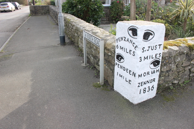
Image: © Nigel Mykura Taken: 30 Oct 2017
This large stone dated 1836 is incorporated into the wall of some cottages and it shows the directions for Penzance, St Just, Pendeen, Morvah and Zennor. It is located at the crossroads of the B3306 and the B3318 at Higher Boscaswell.
Images are licensed for reuse under creativecommons.org/licenses/by-sa/2.0
Image Location
Latitude
50.152609
Longitude
-5.658039