The Broad Stone, Kingsmills Road
Introduction
The photograph on this page of The Broad Stone, Kingsmills Road by Craig Wallace as part of the Geograph project.
The Geograph project started in 2005 with the aim of publishing, organising and preserving representative images for every square kilometre of Great Britain, Ireland and the Isle of Man.

There are currently over 7.5m images from over 14,400 individuals and you can help contribute to the project by visiting https://www.geograph.org.uk
The Broad Stone, Kingsmills Road
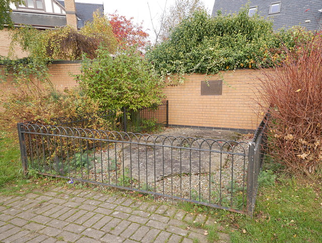
Image: © Craig Wallace Taken: 3 Nov 2017
A large broad stone, dating from before the 15th century. It has a hole in the middle, which probably supported a pillar or town cross. It may have marked a well or the burgh boundary. The area behind was Kingsmills Park football ground, home of Inverness Thistle FC. That was demolished in the 1990s, and replaced with housing.
Images are licensed for reuse under creativecommons.org/licenses/by-sa/2.0
Image Location
Latitude
57.475142
Longitude
-4.214701