Cliffs at Brucehill
Introduction
The photograph on this page of Cliffs at Brucehill by Lairich Rig as part of the Geograph project.
The Geograph project started in 2005 with the aim of publishing, organising and preserving representative images for every square kilometre of Great Britain, Ireland and the Isle of Man.

There are currently over 7.5m images from over 14,400 individuals and you can help contribute to the project by visiting https://www.geograph.org.uk
Cliffs at Brucehill
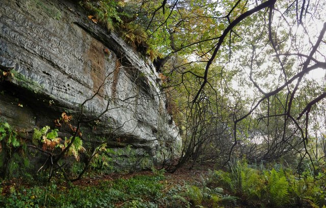
Image: © Lairich Rig Taken: 27 Oct 2017
The map shows a bunching a contour lines here (the cliffs), and a flat area in front. The flat area is a raised beach, and these cliffs were once sea-cliffs (Image / Image). From a distance, the rock face shown here is screened by trees (compare Image). Dripping water keeps the surface damp, creating a home for liverworts and ferns such as Royal Fern (see Image). See Image for a view in the opposite direction.
Images are licensed for reuse under creativecommons.org/licenses/by-sa/2.0
Image Location
Latitude
55.943023
Longitude
-4.590063