Plough Yard, EC2, 1988
Introduction
The photograph on this page of Plough Yard, EC2, 1988 by Robin Webster as part of the Geograph project.
The Geograph project started in 2005 with the aim of publishing, organising and preserving representative images for every square kilometre of Great Britain, Ireland and the Isle of Man.

There are currently over 7.5m images from over 14,400 individuals and you can help contribute to the project by visiting https://www.geograph.org.uk
Plough Yard, EC2, 1988
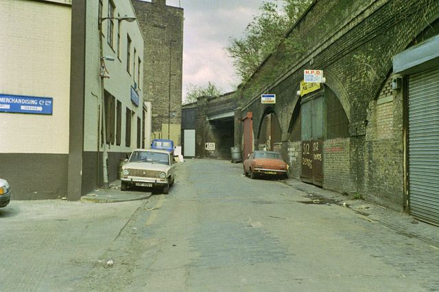
Image: © Robin Webster Taken: Unknown
The way through to Shoreditch High Street is round under the bridge ahead. The viaduct is the old North London approach to Broad Street. Premises using the arches use the arch number as their address. The shuttered arch at the extreme right must be 513, it was indeed a long viaduct.
Images are licensed for reuse under creativecommons.org/licenses/by-sa/2.0
Image Location
Latitude
51.522709
Longitude
-0.079152