Former "Ship Inn", South Quay, Maryport - October 2017
Introduction
The photograph on this page of Former "Ship Inn", South Quay, Maryport - October 2017 by The Carlisle Kid as part of the Geograph project.
The Geograph project started in 2005 with the aim of publishing, organising and preserving representative images for every square kilometre of Great Britain, Ireland and the Isle of Man.

There are currently over 7.5m images from over 14,400 individuals and you can help contribute to the project by visiting https://www.geograph.org.uk
Former "Ship Inn", South Quay, Maryport - October 2017
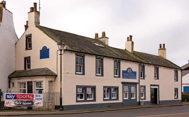
Image: © The Carlisle Kid Taken: 27 Oct 2017
First appears in the 1873 Post Office Directory and on the 1900 OS Map, the "Ship Inn" was acquired by the State Management Scheme in November 1918. It was later let to the Royal Naval Association Club, to whom the premises were sold by the Scheme in 1972. Now Maryport Navy Club Limited, it is still trading. Photograph is for record only - I have no connection with the Maryport Navy Club and cannot advise on their products or services.
Images are licensed for reuse under creativecommons.org/licenses/by-sa/2.0
Image Location
Latitude
54.714813
Longitude
-3.50212