Former Treherbert Library
Introduction
The photograph on this page of Former Treherbert Library by Jaggery as part of the Geograph project.
The Geograph project started in 2005 with the aim of publishing, organising and preserving representative images for every square kilometre of Great Britain, Ireland and the Isle of Man.

There are currently over 7.5m images from over 14,400 individuals and you can help contribute to the project by visiting https://www.geograph.org.uk
Former Treherbert Library
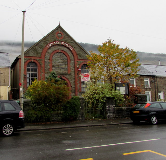
Image: © Jaggery Taken: 26 Oct 2017
Viewed across Bute Street in October 2017 when a Seel & Co AUCTION board is on a window of the building which had been a library from 1958. The building was erected in 1899 as a Calvinistic Methodist chapel.
Images are licensed for reuse under creativecommons.org/licenses/by-sa/2.0
Image Location
Latitude
51.673886
Longitude
-3.534333