The Longford River
Introduction
The photograph on this page of The Longford River by Robin Webster as part of the Geograph project.
The Geograph project started in 2005 with the aim of publishing, organising and preserving representative images for every square kilometre of Great Britain, Ireland and the Isle of Man.

There are currently over 7.5m images from over 14,400 individuals and you can help contribute to the project by visiting https://www.geograph.org.uk
The Longford River
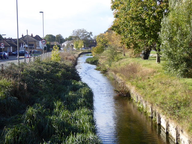
Image: © Robin Webster Taken: 22 Oct 2017
A 17th century artificial cut, here diverted around Heathrow Airport in recent times. It was to supply good water from the River Colne to Hampton Court. Looking upstream, with Bedfont Road on the left.
Images are licensed for reuse under creativecommons.org/licenses/by-sa/2.0
Image Location
Latitude
51.458348
Longitude
-0.472234