Ruins of Castle Raw, Castleraw Road, Loughgall
Introduction
The photograph on this page of Ruins of Castle Raw, Castleraw Road, Loughgall by P Flannagan as part of the Geograph project.
The Geograph project started in 2005 with the aim of publishing, organising and preserving representative images for every square kilometre of Great Britain, Ireland and the Isle of Man.

There are currently over 7.5m images from over 14,400 individuals and you can help contribute to the project by visiting https://www.geograph.org.uk
Ruins of Castle Raw, Castleraw Road, Loughgall
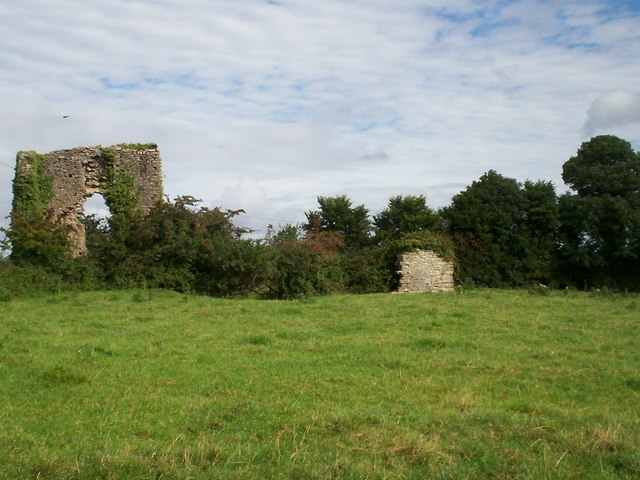
Image: © P Flannagan Taken: 14 Sep 2007
This is all that remains of a 3 storied fortified house in cruciform shape and built within a square entrenchment c. 1618. The ruins comprise a semi-basement and 2 upper floors. Only the N wall of the W wing now stands to approx. original height, the rest of the walling (where it survives at all) being largely reduced to foundations. The walls are of Carrickfergus limestone rubble with a ground floor plinth, projecting 10-15 cms. A window, c. 1.56m wide internally occupies the centre of the N wall.
Images are licensed for reuse under creativecommons.org/licenses/by-sa/2.0
Image Location


Leaflet Map data © OpenStreetMap
Latitude
54.415334
Longitude
-6.572558