Marketplace, Oakham, 2001
Introduction
The photograph on this page of Marketplace, Oakham, 2001 by Derek Harper as part of the Geograph project.
The Geograph project started in 2005 with the aim of publishing, organising and preserving representative images for every square kilometre of Great Britain, Ireland and the Isle of Man.

There are currently over 7.5m images from over 14,400 individuals and you can help contribute to the project by visiting https://www.geograph.org.uk
Marketplace, Oakham, 2001
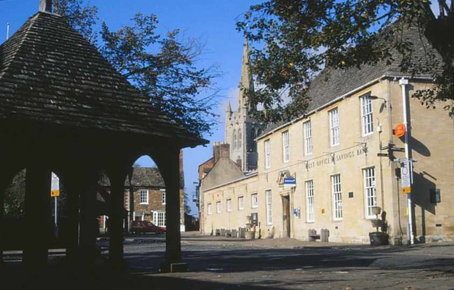
Image: © Derek Harper Taken: 22 Oct 2001
In the foreground is the pump, also shown at http://www.geograph.org.uk/search.php?i=78100062 and described at https://historicengland.org.uk/listing/the-list/list-entry/1361782 . This description seems to have become confused between the pump and the butter cross, since this roof is clearly not octagonal. Across the market place is the post office on the right, and, on the left, the north end of the buildings described at https://www.historicengland.org.uk/listing/the-list/list-entry/1177830 . The market place is crossed by the Rutland Round and the Viking Way.
Images are licensed for reuse under creativecommons.org/licenses/by-sa/2.0
Image Location
Latitude
52.670349
Longitude
-0.728014