Former Royal Dockyard Church, Sheerness Dockyard
Introduction
The photograph on this page of Former Royal Dockyard Church, Sheerness Dockyard by pam fray as part of the Geograph project.
The Geograph project started in 2005 with the aim of publishing, organising and preserving representative images for every square kilometre of Great Britain, Ireland and the Isle of Man.

There are currently over 7.5m images from over 14,400 individuals and you can help contribute to the project by visiting https://www.geograph.org.uk
Former Royal Dockyard Church, Sheerness Dockyard
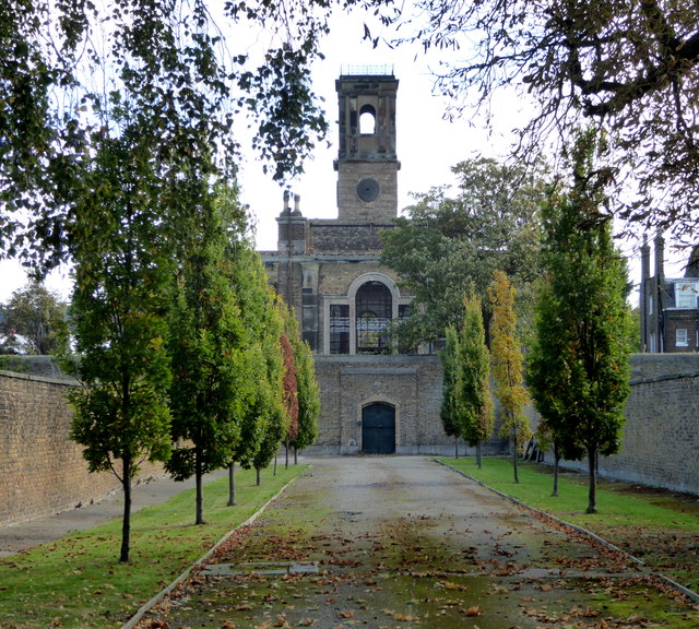
Image: © pam fray Taken: 14 Oct 2017
Viewed from the western end of Church Road. The church was built in 1828 and was severely damaged by fire in the 19th century. Empty since 1970, it was gutted by another fire in 2001. It is Grade II* listed and is undergoing restoration but as a community building rather than a church as it is deconsecrated.
Images are licensed for reuse under creativecommons.org/licenses/by-sa/2.0
Image Location
Latitude
51.442984
Longitude
0.75318