
Main entrance to Trealaw Cemetery
Introduction
The photograph on this page of Main entrance to Trealaw Cemetery by Jaggery as part of the Geograph project.
The Geograph project started in 2005 with the aim of publishing, organising and preserving representative images for every square kilometre of Great Britain, Ireland and the Isle of Man.

There are currently over 7.5m images from over 14,400 individuals and you can help contribute to the project by visiting https://www.geograph.org.uk
Main entrance to Trealaw Cemetery
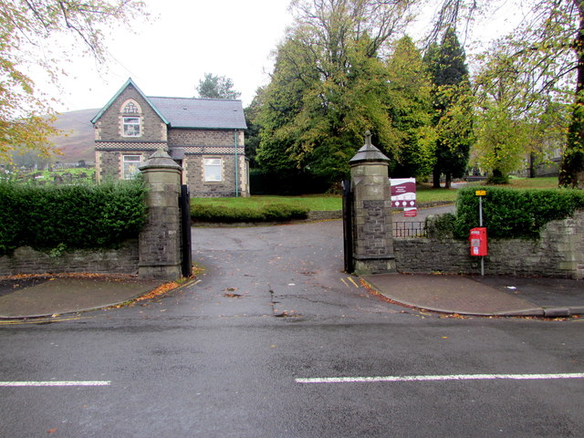
Image: © Jaggery Taken: 10 Oct 2017
From the north side of the B4278 Brithweunydd Road in the east of the village, near the Porth boundary. About ten years after the establishment of the first secular Rhondda cemetery (in Treorchy), this cemetery was created in 1882 on Llethrddu Farm land to serve the communities of mid Rhondda, especially Porth and surrounding districts. Originally known as The Rhondda Joint Cemetery. The cemetery office http://www.geograph.org.uk/photo/5569197 is in the background.
Images are licensed for reuse under creativecommons.org/licenses/by-sa/2.0
Image Location

Latitude
51.617771
Longitude
-3.427861