Edgehill Tower, 2000
Introduction
The photograph on this page of Edgehill Tower, 2000 by Derek Harper as part of the Geograph project.
The Geograph project started in 2005 with the aim of publishing, organising and preserving representative images for every square kilometre of Great Britain, Ireland and the Isle of Man.

There are currently over 7.5m images from over 14,400 individuals and you can help contribute to the project by visiting https://www.geograph.org.uk
Edgehill Tower, 2000
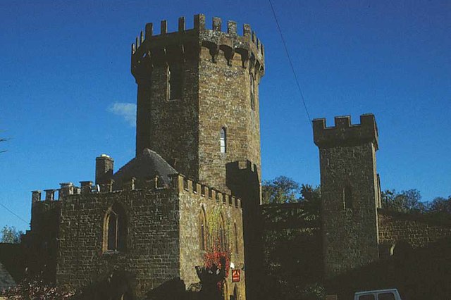
Image: © Derek Harper Taken: Unknown
The sham castle, now The Castle Inn https://www.historicengland.org.uk/listing/the-list/list-entry/1024196 , with the gatehouse https://www.historicengland.org.uk/listing/the-list/list-entry/1355560 on the right. Both listed buildings have been upgraded from II to II*.
Images are licensed for reuse under creativecommons.org/licenses/by-sa/2.0
Image Location


Leaflet Map data © OpenStreetMap
Latitude
52.123835
Longitude
-1.455571