Turkey Brook alongside the London LOOP
Introduction
The photograph on this page of Turkey Brook alongside the London LOOP by Marathon as part of the Geograph project.
The Geograph project started in 2005 with the aim of publishing, organising and preserving representative images for every square kilometre of Great Britain, Ireland and the Isle of Man.

There are currently over 7.5m images from over 14,400 individuals and you can help contribute to the project by visiting https://www.geograph.org.uk
Turkey Brook alongside the London LOOP
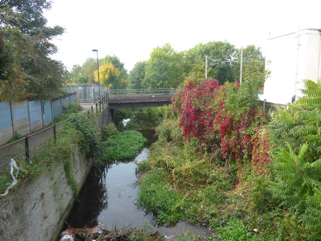
Image: © Marathon Taken: 27 Sep 2017
Turkey Brook rises in Potters Bar. The brook flows in an easterly direction and is joined by other streams before merging with the River Lee Navigation below Enfield Lock. Just ahead it passes under the railway line to the south of Enfield Lock station. This view is from a footbridge at the end of Standard Road. The London LOOP follows the path on the left before crossing over the railway by a footbridge.
Images are licensed for reuse under creativecommons.org/licenses/by-sa/2.0
Image Location
Latitude
51.668007
Longitude
-0.029049