Welsh End Looking Towards Methodist Chapel
Introduction
The photograph on this page of Welsh End Looking Towards Methodist Chapel by Paul Collins as part of the Geograph project.
The Geograph project started in 2005 with the aim of publishing, organising and preserving representative images for every square kilometre of Great Britain, Ireland and the Isle of Man.

There are currently over 7.5m images from over 14,400 individuals and you can help contribute to the project by visiting https://www.geograph.org.uk
Welsh End Looking Towards Methodist Chapel
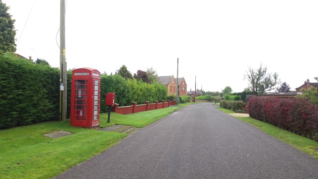
Image: © Paul Collins Taken: 23 Sep 2017
The kiosk and postbox are situated at the Welsh End T junction and, like the road verges, appear well maintained. Closer inspection revealed, however, the absence of any 'phone in the kiosk. I don't know if the absence is temporary or whether the kiosk is due to be removed or converted to alternative use. The Methodist Chapel is visible in the distance.
Images are licensed for reuse under creativecommons.org/licenses/by-sa/2.0
Image Location
Latitude
52.917387
Longitude
-2.7278