Orpington war memorial and High Street, BR6
Introduction
The photograph on this page of Orpington war memorial and High Street, BR6 by Philip Talmage as part of the Geograph project.
The Geograph project started in 2005 with the aim of publishing, organising and preserving representative images for every square kilometre of Great Britain, Ireland and the Isle of Man.

There are currently over 7.5m images from over 14,400 individuals and you can help contribute to the project by visiting https://www.geograph.org.uk
Orpington war memorial and High Street, BR6
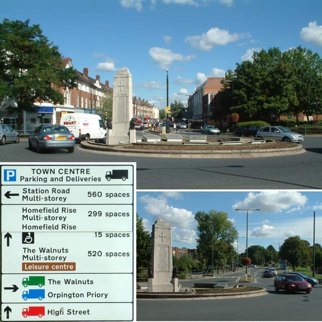
Image: © Philip Talmage Taken: 17 Sep 2005
The main picture and road sign show the view coming into Orpington from the south via the A223 Sevenoaks Road. The smaller picture shows the A232 Spur Road, leading eastwards from the war memorial.
Images are licensed for reuse under creativecommons.org/licenses/by-sa/2.0
Image Location


Leaflet Map data © OpenStreetMap
Latitude
51.369669
Longitude
0.103221