Derelict Romsey Manor Farm
Introduction
The photograph on this page of Derelict Romsey Manor Farm by Philip Halling as part of the Geograph project.
The Geograph project started in 2005 with the aim of publishing, organising and preserving representative images for every square kilometre of Great Britain, Ireland and the Isle of Man.

There are currently over 7.5m images from over 14,400 individuals and you can help contribute to the project by visiting https://www.geograph.org.uk
Derelict Romsey Manor Farm
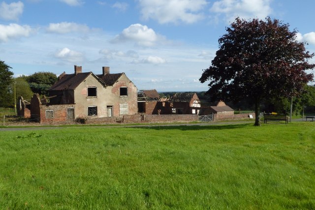
Image: © Philip Halling Taken: 19 Sep 2017
A derelict Romsley Manor Farm. This grid square has more than its share of dereliction, as well as this farm nearby Romseyhill Farm is also in a similar state. Also, just down the road is boarded up former Manchester Inn Image
Images are licensed for reuse under creativecommons.org/licenses/by-sa/2.0
Image Location
Latitude
52.407283
Longitude
-2.055962