The Old Village Tap, Village Hall, Walesby Hill, Walesby
Introduction
The photograph on this page of The Old Village Tap, Village Hall, Walesby Hill, Walesby by Jo and Steve Turner as part of the Geograph project.
The Geograph project started in 2005 with the aim of publishing, organising and preserving representative images for every square kilometre of Great Britain, Ireland and the Isle of Man.

There are currently over 7.5m images from over 14,400 individuals and you can help contribute to the project by visiting https://www.geograph.org.uk
The Old Village Tap, Village Hall, Walesby Hill, Walesby
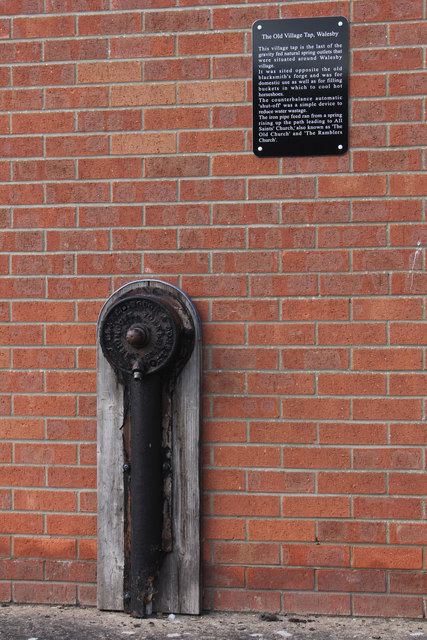
Image: © Jo and Steve Turner Taken: 16 May 2015
Automatic shut off tap by J. Blakeborough and Sons Ltd. of Brighouse, Yorkshire. Founded in 1828 and currently listed as dormant it became part of the Hopkinsons Group in the 1970s. The tap was originally sited opposite the old blacksmith's forge it is the last of the gravity fed natural spring outlets that were situated around Walesby. The tap was fed from a spring on the track to All Saints Church via an iron pipe.
Images are licensed for reuse under creativecommons.org/licenses/by-sa/2.0
Image Location
Latitude
53.416138
Longitude
-0.29539