Land behind the King?s Head, Woodchurch Road
Introduction
The photograph on this page of Land behind the King?s Head, Woodchurch Road by John Baker as part of the Geograph project.
The Geograph project started in 2005 with the aim of publishing, organising and preserving representative images for every square kilometre of Great Britain, Ireland and the Isle of Man.

There are currently over 7.5m images from over 14,400 individuals and you can help contribute to the project by visiting https://www.geograph.org.uk
Land behind the King?s Head, Woodchurch Road
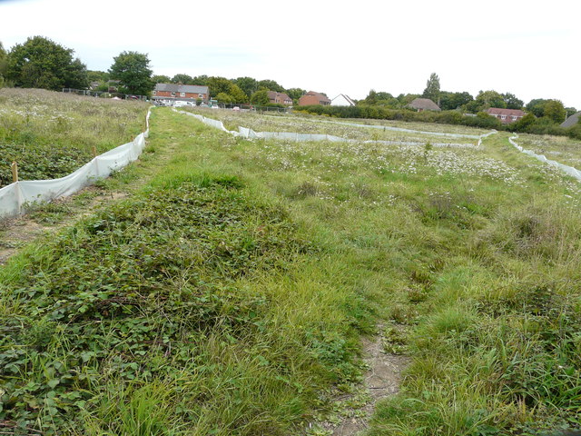
Image: © John Baker Taken: 3 Sep 2017
Planning permission has been granted by Ashford Borough Council under application number 15/01496/AS for “residential development comprising 19 dwellings including 15 x 2 storey dwellings and 4 x 1 bedroom flats with associated infrastructure and services including garaging/provision for parking, open space, landscaping and a sustainable urban drainage system”. Two footpaths converge here and their routes, through the grass, have been marked out by the lengths of polythene affixed to small, wooden posts. The King’s Head is out of sight, as it is hidden by the two, large trees on the left.
Images are licensed for reuse under creativecommons.org/licenses/by-sa/2.0
Image Location
Latitude
51.107743
Longitude
0.814927