View from The Leas
Introduction
The photograph on this page of View from The Leas by John Baker as part of the Geograph project.
The Geograph project started in 2005 with the aim of publishing, organising and preserving representative images for every square kilometre of Great Britain, Ireland and the Isle of Man.

There are currently over 7.5m images from over 14,400 individuals and you can help contribute to the project by visiting https://www.geograph.org.uk
View from The Leas
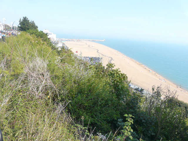
Image: © John Baker Taken: 27 Aug 2017
The current activity, which started at the end of February, includes raising the levels of the site to an acceptable level in preparation for the development of the former Rotunda Amusement Park, Marine Parade. Further information may be obtained here http://www.folkestoneseafront.com/news/seafront-site-activity-dredging-and-raising-levels/ Planning permission has been approved by Folkestone and Hythe District Council under application number Y16/0044/NMC as a “non material change to Y12/0897/SH - Outline planning application with all matters (access, scale, layout, appearance, landscaping) reserved for the redevelopment of the harbour and seafront to provide a comprehensive mixed use development comprising up to 1000 dwellings (C3), up to 10,000 square metres of commercial floorspace including A1, A3, A4, A5, B1, D1 and D2 uses as well as sea sports and beach sports facilities. Improvements to the beaches, pedestrian and cycle routes and accessibility into, within and out of the seafront and harbour, together with associated parking, accompanied by an Environmental Statement”. My previous Image shows the sinuous outline of, what was to become, a boardwalk (recycled, wooden railway sleepers) for people to walk along. The present view shows the boardwalk and the Image, which appears as a white blob to the right of the ‘path’.
Images are licensed for reuse under creativecommons.org/licenses/by-sa/2.0
Image Location


Leaflet Map data © OpenStreetMap
Latitude
51.076863
Longitude
1.177295